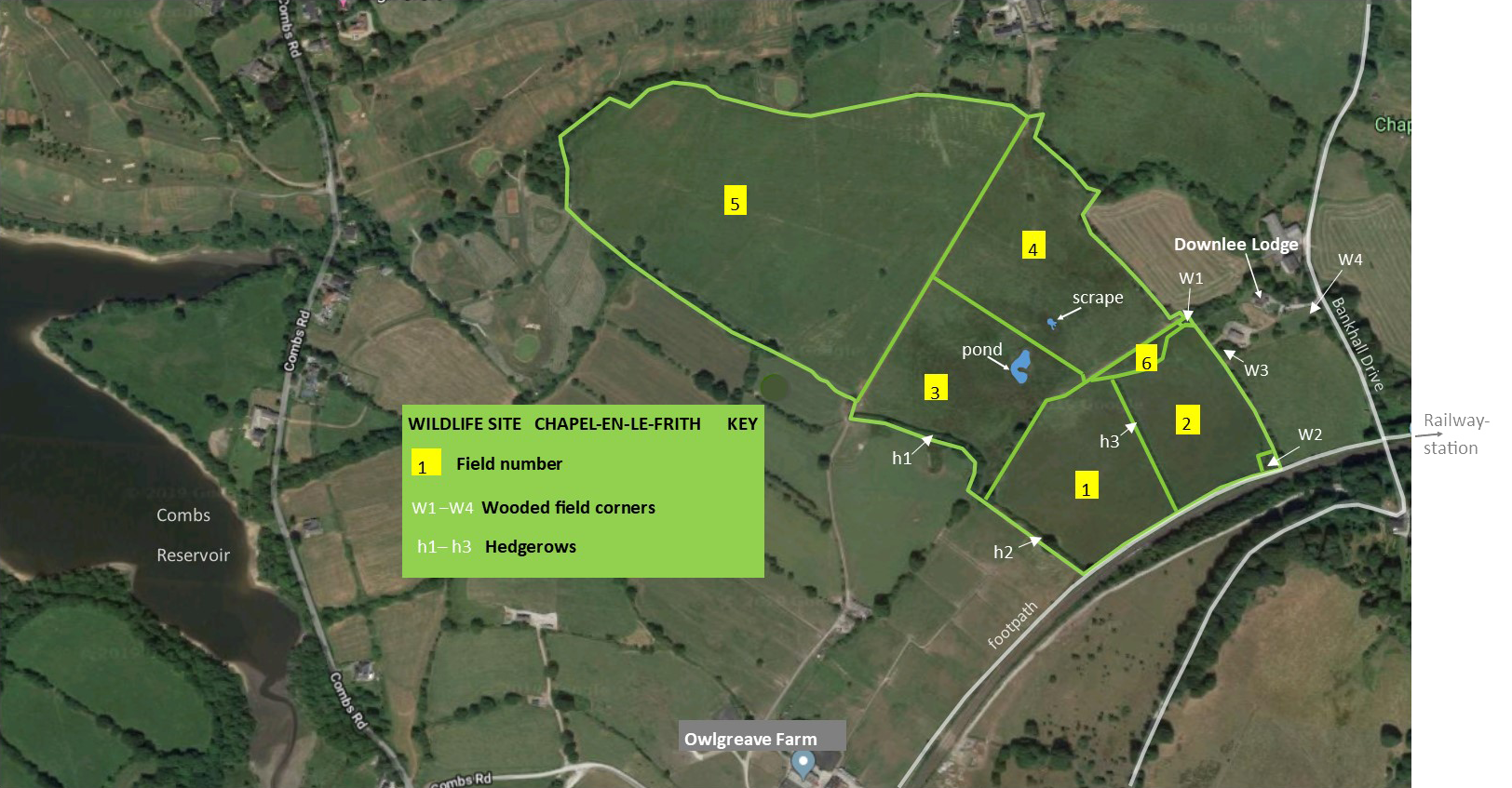
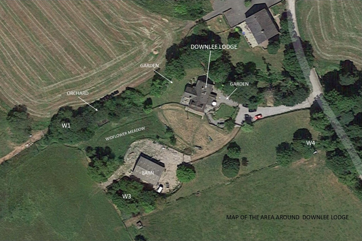
Wildlife site maps
The two maps below are based on Google Earth satellite images
Map 1 shows the boundaries and location of features in the officially designated Derbyshire Local Wildlife Site, HP197, which is located at UK Ordinance Survey Map Reference SK0479
Map 2 shows some of the habitat features and locations where photographs were taken around Downlee Lodge, which is adjacent to the designated wildlife site.